Friday 19 December 2014

How good is eGovernment?

A few months ago I published a short piece on the evaluation of eGovernment web maps in the ISCR newsletter (Competition and Regulation Times).  

The piece reflected on my usability work creating an evaluation method for web mapping with Spatial IQ last summer.  If you are interested in reading the piece, its available at: http://www.iscr.org.nz/f958,25113/CRT_September_2014_web.pdf


Wednesday 17 December 2014

Personal reflections on Geocart

This year at the Geocart conference I was elected to the New Zealand Cartographic Society committee.  Geoff Aitken, the editor of Cartogram, asked me to write a piece for the society's newsletter.

Click through to read the full article: http://cartography.org.nz/images/files/cartogram/NZCS_Cartogram-077_Dec2014.pdf

I raised two key challenges for the conference and cartographic industry in New Zealand - the lack of student and female involvement in the conference (despite high attendance by women).  Let me know what you think!

Monday 15 December 2014

The Geospatial Skills Shortage in New Zealand

My paper on the geospatial skills shortage in New Zealand has just been published.  See: http://onlinelibrary.wiley.com/doi/10.1111/nzg.12054/abstract

If you are interested in applying for a GIS or geospatial job in New Zealand, the paper is worth a read as it details the dimensions of the skills shortage and identifies the skills geospatial employers are seeking in New Zealand.

Summary of the paper:

Geospatial technologies span governmental, academic and private commercial sectors, and their potential for growth is considerable. The USA and Australia have trouble meeting demand for geospatial skills. This paper reports on a national survey of 157 organisations that identified a similar geospatial shortage in New Zealand. The paper also details dimensions of the shortage and the current frameworks for meeting the shortfall of skilled professionals. Arising from this skills gap, key challenges facing both the geography and geospatial communities are identified and discussed: raising student numbers, gaining experience, up-skilling current professionals and raising awareness of the value of the geospatial skillset.


Importance of geospatial academic qualifications and prior experience for most recently advertised position by New Zealand geospatial employer.


Paper available at: http://onlinelibrary.wiley.com/doi/10.1111/nzg.12054/abstract

Sunday 7 December 2014

MGIS Thesis Talks: Wednesday December 10 5-6pm, CO304, Cotton Building, Kelburn Campus.

MGIS student thesis talks on Wednesday 10 December, 5-6pm
Cotton 304, Kelburn Campus, Victoria University of Wellington

::All welcome::

Modelling irrigation in an ecosystem services framework: A GIS module for the Land Utilisation & Capability Indicator
Stuart Easton
Supervisors: Bethanna Jackson, Mairéad de Róiste


There is a need for spatially explicit modelling of irrigation so that inefficiencies in water use can be determined and targeted for management or mitigation at sub-field scales. A complimentary need exists for irrigation modelling within ecosystem decision support tools so that nutrient and water movements can be accurately quantified. Preliminary outputs from a spatially explicit irrigation simulation model are presented. The model aims to add irrigation flows to the hydrology component of the Land Utilisation and Capability Indicator (LUCI) ecosystem service modelling framework and produce standalone outputs that can inform management decisions. 


Waiting and weighting: Public transport model sensitivity to waiting time and schedule deviation
Richard Law
Supervisors: Mairéad de Róiste, Toby Daglish, Yigit Saglam


Models of public transportation systems can take a variety of forms, but are typically based on the schedule and adopt assumptions about passenger waiting strategies that together lead to a representation that may not accurately  reflect the operation of the real transit system, such as delays and missed connections. Using the complete record of Greater Wellington Regional Council's real-time information (RTI) system, I develop more realistic models of Wellington's public transportation system, and quantify the error associated with travel time estimates and the measurement of spatial accessibility made from models that lack this additional information.

Monday 3 November 2014

This blog article really spoke to me today

http://pgbovine.net/why-academics-feel-overworked.htm

"why do academics so often feel overworked?"
"I think the answer lies in the fact that, as an academic, your work comes from multiple independent sources...None of these sources of work know of or care about one another. They are completely independent. Thus, it's totally up to you to plan your time to balance all of these obligations. Instead of a single boss giving you work to do, academics have seven independent “bosses” pulling them in different directions."

Especially in a week of grading overload and setting up research students for the summer, this really struck home!


Friday 31 October 2014

VUW Spatial Excellence

Of the six possible undergraduate and postgraduate finalists in the New Zealand Spatial Excellence Awards (http://www.nzspatialawards.org.nz/).  VUW has picked up 4 finalists!

Michelle Boodee and Jonathan Ball have been shortlisted for the Student of the Year (undergraduate) while Andrew Clouston and James Richardson were shortlisted for the Student of the Year (postgraduate).

Of these four excellent finalists, three are closely involved in the MGIS.  Michelle is about to enter her first year of the MGIS programme, Jonathan has just finished his first year and Andrew has just submitted his Master's thesis.

Congrats!

Wednesday 22 October 2014

Women in leadership at VUW


At the opening of Victoria university's women in leadership day. Great attendance. 

While women are increasingly filling a reasonable proportion of academic roles, the number at more senior Ievels is low. Interested in finding out how VUW are looking at this. 

Sunday 14 September 2014

Intergraph user conference

This might well be my last conference of the season. I've been invited to give a keynote talk on the transport project I've been working in with the ISCR (http://www.iscr.org.nz/n1.html).


A nice variety of talks so far but with a heavier emphasis on vendor talks than I would like. 

The break up of geospatial professions across the different platforms is still strange for me but it does mean that you meet different people at the different user conferences. And the Intergraph conference is very welcoming and inclusive. Worth going along to if you're scoping out the NZ geospatial scene. 


Wednesday 3 September 2014

Geocart - mapsmiths unite!

I'm up in Auckland for the week, getting my cartography fix and catching up with what's new in the world of New Zealand mapping.  


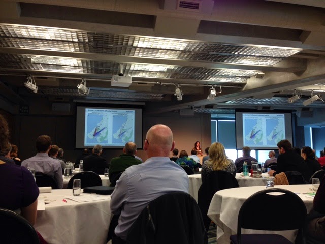
The 2014 Geocart conference in Auckland got off to a good start on Tuesday night with an icebreaker.  Selfie with Roger Smith and Kenneth Field as the last cartonerds* or mapsmiths* standing.

The conference is an interesting mix of cartography and GIS so far spanning the hidden work of women cartographers, the need for critiques and the important role of cartography on the wider science stage.


Stuart Easton was the first of the MGIS students to present on his irrigation modeling work with LUCI on Wednesday.


Some interesting presentations on tools expanding the contemporary mapping methods such as GNS' use of leapfrog for a 3D geological map of Dunedin.


Ken Field's plenary was a personal whistlestop tour of much of current cartography and the difference between neo-and traditional cartography.  Ken also covered the difficulty in deciding what to call yourself - cartonerd, mapsmith, cartographer, map maker, the list is almost endless.  The talk was an interesting, if somewhat confrontational, approach to the importance of critiquing current map design.


Richard Law (the second of the MGIS students in the hotseat) presented on his public transport modelling work with the ISCR.  


Paul Goodhue (University of Canterbury MGIS student), Richard Law, Stuart Easton (Victoria University of Wellington MGIS students)

This is the first geocart (which is held every two years) with an MGIS student presence.  It was great to see the students holding their own and actively participating in the conference. 


The importance of critical thinking

If you ever wondered why the GIS assessments at VUW require you to move outside of your comfort zone...

http://www.nytimes.com/2014/09/03/upshot/the-economic-price-of-colleges-failures.html

Develop those independent critical thinking skills and you'll be in demand.

Tuesday 2 September 2014

Beyond Mapping - a comprehensive online GIS resource

Just released a GIS series of 4 books detailing: 
Applying Map Analysis Tools and Techniques,
Understanding Spatial Patterns and Relationships, 
Spatial Reasoning for Effective GIS, and
Beyond Mapping: Concepts, Algorithms and Issues in GIS 

Produced by Joseph K. Berry as a compilation of his columns in GIS World.


Sunday 31 August 2014

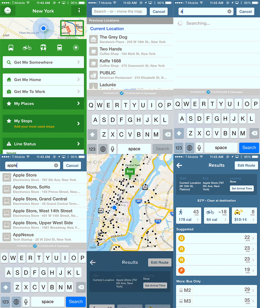
CityMapper versus Google Maps

I loved this write up of a usability comparison of CityMapper versus Google Maps.  Off to download the app...


Thanks to Stuart Easton for the link

Sunday 3 August 2014

A simple FAQ (Frequently Asked Questions) when you are looking for a PhD supervisor

I got the following email in my inbox this morning - I get a few of these each month (usually of a better quality!).

Hello ma,
Goodevening to you, my name id [potential student's name was inserted here],i very much like to pursue a phd programe in GIS ,i already have an Msc GIS  ,pls what advice wpuld you give me.
Thank you.


I thought an FAQ would be useful to refer potential students towards.

When writing to a potential supervisor, especially if you don't know them, bear the following in mind.

1. Address them appropriately!  For example, Dear Dr de Roiste.  When you don't know the person, its best to be more formal and address them with their academic title (Dr) and surname (de Roiste).

2. Introduce yourself.  A sentence is fine; i.e. My name is XXX.

3. Explain why you are contacting that person.  Mention the research area that they work in that coincides with your interests or an article they've written that you've read - and make sure you've read it!  Just writing how amazing their work was and how wonderful they are is unlikely to win any brownie points - think about how what they've written has interested you in applying to be supervised by them and detail this.

4. Detail what type of research you would like to do for your PhD or MSc.  A paragraph with a clearly defined research area is a good starting point at this stage but a more detailed and clearly defined idea is best.  A two page outline with reference to relevant literature (and the associated bibliography) and your proposed research question as well as an indication of how you intend to undertake the study is best.  If you have this two pager, attach as a separate document.

5. Detail your qualifications - include relevant academic and work experience, e.g. your degree information, Masters thesis topic and relevant grades.  Attach your CV with a break down of your courses and grades.

6. Ask for feedback on the topic.  Your potential supervisor might want to have an input before you apply to see how well you might work together or to suggest a direction more in keeping with their research interests.  Although a number of univerisities discourage staff from doing this before the student starts - so don't take it to heart if they do not provide you with detailed feedback.

7. Do not ask about how to apply - you can easily get this information from the university website.

8. Equally, don't ask how much fees are and if they can waive them for you!  Scholarship information is also usually available on the university website.  If you are interested in a particular scholarship, in the first instance contact the international office and in the second, feel free to ask your potential supervisor as they may be able to add extra information.

For example, at Victoria University of Wellington: visit http://www.victoria.ac.nz/international/ for information on how to apply, fees for international students, information on scholarships and what's it like to live in Wellington.

9.  Proof read your email!  Ideally, you should treat your email like a formal letter.  Make sure you do not have any grammar or spelling mistakes.  A poorly worded email, like the one above, is far less likely to result in a PhD at the university you are interested in and creates a very poor impression.  Do not use text speak.

10.  If you haven't heard back in two weeks, email them again.  Your potential supervisor may have been particularly busy the day your email arrived and it slipped their notice.  If you haven't heard back from them after two emails - most likely they are not the supervisor for you!  Remember you'll have to work with them so making sure they are interested and engaged with your topic and are interested in taking you on as a student is fundamental!

11.  Good luck!  Finding the right supervisor is an important step.  If successful, that person will guide you in the development of your research and a good working relationship is vital.  If you have a supervisor with a direct interest in your area, they will be more able to provide helpful feedback on your project and your progress.  They will already be familiar with the literature and be better able to guide you in your reading and finding a unique research topic.

A PhD or MSc research thesis can be a rewarding and really engaging experience. Getting the building blocks right is a sensible step.

Thursday 31 July 2014

MGIS GISC 401 Kaikoura fieldtrip dates confirmed: 23 February

The fieldtrip dates for the 2015 MGIS for GISC 401 in Kaikoura is confirmed as the 23rd to the 27th.  AUT and VUW students will need to make their own travel arrangements to Picton, Christchurch or Kaikoura.  Students arriving in Picton and Christchurch will need to arrive in time for the onward journey to Kaikoura.  Times will be confirmed closer to the dates of the fieldtrips.

Thursday 24 July 2014

A little off the GIS topic but equally apt for GIS as for Geography

Article: 

How to Succeed in Business with a Degree in Geography


http://news.aag.org/2014/06/succeeding-in-business/

I came across this article via the AAG today - Geography graduates (or soon to be graduates) should find it worth bearing in mind.

Tuesday 22 July 2014

North Atlantic Skies

I can't tell you how much it bothers me that I saw this first on the Paul Henry Show (which I am deliberately not linking to).  In my defense, it was because I was watching what came on next...

Such an interesting visualization of the aircraft flying over the North Atlantic.


Thursday 17 July 2014

Wednesday 16 July 2014

NZSEA- New Zealand Spatial Excellence Awards


NZSEA awards were launched this week.  The categories are:

Organisational Awards
Individual Awards
Award for Export
Professional of the year
People & Community
Student of the year (Undergraduate)
Innovation & Commercialisation
Student of the year (Postgraduate)
Environment & Sustainability
Education & Professional Development
Spatial Enablement
Young Professional of the year
Technical Excellence


Entry this year is free and if you or your organisation have a project or person in mind - go for it!

Tuesday 15 July 2014

Importance of base maps

Interesting (and horrific) article on the controversy surrounding the burial of children in a Mother and Babies home in Ireland.

One of the items that caused confusion was the interpretation of an historic map of the area.  Reading about the interpretation of the maps and the proliferation of misinterpretation is disturbing.


http://kettleontherange.wordpress.com/2014/06/27/an-international-publicity-frenzy-and-my-mother/ 

Sunday 13 July 2014

The road that wasn't there

Just booked my tickets for this fun sounding play.  Yes, its quite kid focused but should be fun - if you're keen on joining me. I'm going to the Saturday night 7pm showing.


Presented by trick of the light theatre
This is a story about a girl who followed a map off the edge of the world…
In New Zealand there are some 56,000 kilometres of paper roads – streets and towns that exist only on surveyors’ maps. Or do they? A young woman strays from the beaten track and finds herself in a paper world. It seems a land of possibility but she soon discovers that things that happen in the fictional world can have frighteningly real consequences.
From an award-winning company comes an original fairytale drawn from the twitchy edges of children’s literature – a dark world reminiscent of Coraline, Pan’s Labyrinth, and Margaret Mahy. Combining puppetry, shadow play, and live music, this is a curious tale for intrepid children and adventurous adults…
“Thoroughly enchanting and totally engrossing, The Road That Wasn’t There is a must see show for all ages.” – The Dominion Post
“Probably the most beautiful kids’ show I’ve ever seen.” – Edinburghia2012
Suitable for audiences of all ages.


Gender in the GIS workforce

Not an especially informative article - but one of the first I've seen.

http://www.siba.com.au/News/News-Articles/Gender-in-the-GIS-workforce.aspx

Wednesday 9 July 2014

Fed up of your boring quickest route algorithms?

Try the new scenic route algorithm instead...


Yahoo researchers are crowdsourcing the underlying 'scenic' information.  


As we're heavily using a shortest path algorithm for our commuting project, this really struck a cord.  One of the questions we're often asked by pedestrian and cycling commuters is how do we account for things like safety on cycling routes (the safest route may not be the quickest one!) and scenery.  Nice to think that Yahoo is out there solving that part of our puzzle :) 

Friday 27 June 2014

G[eography]oogle

Ed Parsons currently the geospatial technologist at Google plays a significant role in putting the Geography into Google (see what I did with the title, did you?)

http://www.independent.co.uk/life-style/gadgets-and-tech/features/the-man-whos-making-google-maps-smarter-9544478.html

I've been banging one particular drum for a while ...

"Most of our cartographic principles were tied to paper. You make a map, print it and everyone sees it the same. For 1,000 years, that's what we've done. Now, our media are so dynamic that maps can be personal, they can change."

But there is an underside to this that as a discipline, GIS and/or cartography aren't yet on top of.

Google maps change based on where you access them.  That's not just the centre but the underlying map data - that thing you take for granted as being fixed or authoritative in some way.  Take the Ukraine as an example...


Thursday 26 June 2014

Google's purchase of Skybox

http://techcrunch.com/2014/06/10/google-is-confirming-purchase-of-satellite-startup-skybox-imaging-today/

A $500 million purchase of Skybox has provided Google with their own high resolution satellite imagery.  While it appears to be primarily focused on serving the imagery needs of organisations, it should be interesting to see how it will filter through to Google Maps and more neocartography users.

Wednesday 25 June 2014

MapGyver

MacGyver and Maps: What's not to like?


Well, fine, be picky!  Love that the map is a standard one of the US - just think of the cartographic genius behind those plans! :P

Tuesday 24 June 2014

Get to know a projection...

http://www.wired.com/2014/06/get-to-know-a-projection-the-space-oblique-mercator/

Coincidentally, I've just finished pulling together a lecture which includes projections when this happened to catch my eye.  Without John Parr Snyder, Landsat (a remote sensing satellite taking continuous images of the Earth's surface) would just be pretty pictures - as opposed to a real mechanism to map land cover change.  Because Landsat records the 3D surface of the Earth as a 2D image, it needs some means of understanding where each part of that image is located on the Earth.  Every 2D representation will have some distortion (don't believe me? Try peeling an orange and using the peel to prefect represent the 3D orange as a flat surface sometime!).  Knowing what that distortion is means that we can match up each image to where it should be on the Earth and with other images.

Snyder’s Space-Oblique Projection

Thursday 19 June 2014

How can we ensure that GIS is a good career choice?

I'm on a writing retreat in Taupo working on a paper on usability heuristics and another on detailing some of the lessons learnt from developing the MGIS with the University of Canterbury and AUT.  One of the papers I've just come across, while old, has really struck a cord.  Muki Haklay, in 2007, wrote about the need to ensure that we educate employers about why spatial is special and therefore make it a valued and valuable career choice for future GIS professionals (see: http://discovery.ucl.ac.uk/16224/1/16224.pdf).

In New Zealand (and Australia for that matter), we have strong demand for graduates with GIS skills (see: http://www.victoria.ac.nz/sgees/about/staff/pdf/GeospatialSkillsShortageReport.pdf).  We're in a fairly unique position to be able to define a career path that is both rewarding and useful for future professionals.  However, the importance of reaching out beyond the profession to analysts, managers, decision makers and key stakeholders is still important.  Just because we're in demand does not mean the industry cannot grow and new opportunities to apply spatial thinking cannot be developed.

As I write about usability for web mapping, it got me thinking about the usability of GIS tertiary education and the need to stretch outside the traditional boundaries to engage with industry, government and the primary and secondary education sectors.  The importance of raising the profile of spatial thinking as a supplementary element of a role or as the core skill in your role are two potentially different careers but with important synergies.  We need to acknowledge that the 'mainstreaming' of GIS opens the industry but may very well be to its benefit.

Friday 13 June 2014

Thinking about time and space

Menno-Jan Kraak has just released a new book on "Mapping Time" which deals with the issue of visualizing time over space.  Currently available as a hard cover (and soon to be in VUW's library!) as well as a soon to be released ebook.


Thursday 12 June 2014

Monday 2 June 2014

Googling in 3D


Looks like Google are producing a tablet that allows you to map your surroundings in 3D.  I'm not sure whether to be creeped out or impressed...


Wednesday 28 May 2014

Aggregate-disser: overcoming the problems of aggregate data?

This post by Brandon Martin-Anderson details a way to disaggregate spatial data - for example, census data is normally provided at an administrative level like meshblock in NZ or census tracts in the USA but this may not appropriately represent the underlying data.


The aim of disaggregating the data is to estimate the underlying distribution of the data which has been aggregated.  For example, locations of households rather than the total number of households in a meshblock.  The tool proposed is Java based and can produce a CSV (comma delimited file).  

Worth a look if you're interested in using alternative ways of visualising your data - but be careful - it can seem more accurate than it actually is!


Tuesday 27 May 2014

An ESRI Story map showing the locations of different Scottish distilleries and sorting by single malt characteristics


I'm not a great proponent of story maps (they seem a little over hyped to me) but I thought the idea behind this Scottish Whisky map was neat - get it?? :)

Monday 26 May 2014

Michelle Boodee: Summer Scholarship with the School of Geography, Environment and Earth Sciences at Victoria University of Wellington and Spatial IQ


Over the summer of 2013-2014, I received a Summer Research Scholarship with Victoria University of Wellington - VUW - and Spatial.IQ.  The scholarship funded my work on a project to develop a set of usability heuristics for New Zealand local government web mapping applications. My time was split between the GIS lab at VUW and the Spatial IQ offices in the Botanic Gardens in Kelburn.  I worked in collaboration with Mark Shaw (Director at Spatial.IQ) and Mairead de Roiste (Senior Lecturer of GIS at VUW).

The main aim of my summer’s project was to create a set of usability heuristics based on professional experience and a review of geospatial and general web usability literatures. The heuristics needed to cover each component of a web mapping application - accessibility (findability), the map itself, the functions of the application, its performance and overall user experience. I then evaluated local government websites across New Zealand and scored each local council’s web maps according to these heuristics based on three different use cases of varying degrees of complexity.

Evaluating the usability of local government web maps is a new extension of Spatial.IQ’s What’s My Spatial.IQ? project. What’s My Spatial.IQ looks at local government web mapping, the technology behind the mapping, and the usability of those mapping applications. By using a robust set of usability heuristics to determine the quality of local government web mapping applications, we can garner an understanding of the overall quality of local government web mapping in New Zealand in order to provide a starting point for improving the standard and value of local government map-based information provision.

The GIS powerhouse that is Duane Wilkins...


Ok, it may just be that I adore the song accompanying this video but I had to share this.  Its one of the overview of all things GIS Duane Wilkins produces in his now infamous (at least in the NZ GIS community) videos.  VUW GIS students are extremely lucky to have Duane come in nearly every year to share his views on GIS and his rather incredible work history (Crown Forestry Rental Trust, Iraq, Department of Conservation, Project Management for Maori GIS projects, the list goes on...).


Wednesday 21 May 2014

QGIS tutorials

Some rather nice looking QGIS (an open source and free GIS software) video tutorials - available from Mango maps at: http://qgis-tutorials.mangomap.com/post/79334660226/qgis-video-tutorials-module-1-the-interface

GED Seminar: Accessibility, commuting and the car ownership decision - Thursday 22 May 4-5pm Kelburn

GED Seminar Series
Accessibility, commuting and the car ownership decision

Thursday 22nd May, 4-5pm
Cotton Seminar Room 304
Victoria University of Wellington, Kelburn Campus

Abstract:
Rising fuel prices, costly transport infrastructure, congestion, external environmental impacts and impending peak oil difficulties highlight the importance of understanding the economic decisions behind commuting patterns.  Where a person lives and works are important factors in an individual’s transport decision and are key determinants for car ownership. However these spatial factors are interlinked and an individual’s residential location is also determined by where they work and their transport choices among other factors. Households are also likely to compromise on their commuting, car ownership and residential choices according to the needs of multiple members of the household.
Based on the New Zealand household travel survey, this study asks the question of how residential and work locations, and by what means a person commutes affects the number of vehicles they own through a joint decision making process for individuals within a household.  By calculating the accessibility to work over a geographic transport network of where a person lives as well as a large number of other residential alternatives, this study uses a discrete choice model to explore the extent to which these spatial factors influence car ownership of households.  This study breaks new ground by developing first a joint decision model and second applying it to the three levels of that joint decision (car ownership, residential location and commuting strategy). 

Speakers: Mairead de Roiste, Toby Daglish and Yigit Saglam

Tuesday 20 May 2014

Love this: NASA space station live streaming in HD of Earth


Site also shows where the space station is over on a map to the right of the streaming video.  I especially love the part of the space station that's visible!

Friday 16 May 2014

Gartner's Hype Cycle

While the post is primarily about location intelligence, there are also interesting points on the graph (especially re: Big Data).


Thursday 15 May 2014

Tuesday 13 May 2014

Open Addresses

I haven't used it yet, but seems like another great open data initiative.  Open addresses - add to it or use for geocoding...

New Zealand's most deprived areas


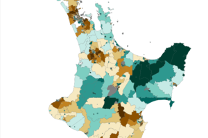
New Zealand Herald has posted an interactive map of deprivation in New Zealand using the latest deprivation index.

Thursday 8 May 2014

New Zealand Oil Spill Map

This rather neat visualization was produced by a Wellington based data science and data visualization company - Dumpark.

The map based data visualization produced for Greenpeace shows the potential spread of oil after a deep sea oil drilling well blow out.


[via Andrew Parnell]


Wednesday 30 April 2014

Individual house postcodes

The Irish government has just released a postcode system for Ireland - to be called Eircode.  Up until now, the country did not operate one.  However there are some interesting aspects to the postcodes.  First, it is for every individual address in the State.  The code comprises of a routing key and then a unique identifier.  But here's the kicker; the routing key isn't directly related to towns or counties (similar in system to that used for phone number prefixes).  While the system provides spare capacity for future growth in different areas (a problem with some current postcodes), it will not help 'locate' an address based on where it is on a road or to significantly narrow down the area.  The applications to emergency services will therefore be dependent on their buying into the system and the methods they have in place to update the database.  As many addresses in Ireland are non-unique, this may solve some of the issues with logistics but the lack of openness may hamper its wider appeal.

Monday 28 April 2014

The Wellington ESRI GIS Regional Meeting April 11th 2014


On the 11th of April this year, the School of Geography, Environment and Earth Sciences (SGEES) sponsored the ESRI GIS User Group meeting in Wellington. This meeting attracts participants from industry, government and the tertiary sector to dissemination information on GIS projects in the region.  This was the 5th meeting of a series of regional meetings throughout New Zealand.  The meeting attracted just under 80 people. The School was well represented with seven attendees and a number of recent alumni.

Andrew Rae, the SGEES GIS Technician, is a member of the national ESRI GIS User Group committee and he organised the day’s events as well as brought his unique charm and wit to the event by acting as MC.

These meetings inform GIS professionals on updates to the tools and software.  The meeting hosted two workshops by Eagle technology on updates and developments in ArcGIS.  Many of these developments are focused around mobile services and cloud computing.  Of particular interest to spatially aware researchers is the provision of a soon-to-be-released free web service of LINZ aerial photography that will work both with ArcGIS and other GIS software, such as MapInfo.

Talks during the day covered nutrient farm management systems (of particular interest to SGEES researchers working in hydrological modelling), addressing and geocoding, automation of mapping services using Python, fence maintenance and the greater availability through web services of Statistics New Zealand data.  Mairead de Roiste, SGEES Senior Lecturer in GIS, presented on her work with the Institute for the Study of Competition and Regulation (ISCR) on their SET (Spatial Econometric Transport) model.
The talks and presenters were from a wide variety of backgrounds (conservation, research, central government, consultants, etc.) and covered different methodologies and tools; giving the audience a great insight into the work in GIS being done across the region by some very passionate professionals.

The final presentation was by the GIS in Conservation group (GIC).  This group is seeking GIS volunteers to work with organisations implementing GIS in conservation efforts, such as Zealandia and Predator Free New Zealand.  The day finished with drinks and nibbles with a chance to socialise and chat about the day’s events.

The interest from the School of both current and former students in attending this event is illustrative of the growth of this area and the key role Victoria University and the School have played and continue to play in shaping and supporting the geospatial industry.

Wednesday 23 April 2014

Tuesday 22 April 2014

Interested in learning more about remote sensing?

Karen Joyce, a lecturer in Australia (and formerly of DOC and GNS in New Zealand), has put together a website explaining some of the important concepts.