Friday 27 June 2014

G[eography]oogle

Ed Parsons currently the geospatial technologist at Google plays a significant role in putting the Geography into Google (see what I did with the title, did you?)

http://www.independent.co.uk/life-style/gadgets-and-tech/features/the-man-whos-making-google-maps-smarter-9544478.html

I've been banging one particular drum for a while ...

"Most of our cartographic principles were tied to paper. You make a map, print it and everyone sees it the same. For 1,000 years, that's what we've done. Now, our media are so dynamic that maps can be personal, they can change."

But there is an underside to this that as a discipline, GIS and/or cartography aren't yet on top of.

Google maps change based on where you access them.  That's not just the centre but the underlying map data - that thing you take for granted as being fixed or authoritative in some way.  Take the Ukraine as an example...


Thursday 26 June 2014

Google's purchase of Skybox

http://techcrunch.com/2014/06/10/google-is-confirming-purchase-of-satellite-startup-skybox-imaging-today/

A $500 million purchase of Skybox has provided Google with their own high resolution satellite imagery.  While it appears to be primarily focused on serving the imagery needs of organisations, it should be interesting to see how it will filter through to Google Maps and more neocartography users.

Wednesday 25 June 2014

MapGyver

MacGyver and Maps: What's not to like?


Well, fine, be picky!  Love that the map is a standard one of the US - just think of the cartographic genius behind those plans! :P

Tuesday 24 June 2014

Get to know a projection...

http://www.wired.com/2014/06/get-to-know-a-projection-the-space-oblique-mercator/

Coincidentally, I've just finished pulling together a lecture which includes projections when this happened to catch my eye.  Without John Parr Snyder, Landsat (a remote sensing satellite taking continuous images of the Earth's surface) would just be pretty pictures - as opposed to a real mechanism to map land cover change.  Because Landsat records the 3D surface of the Earth as a 2D image, it needs some means of understanding where each part of that image is located on the Earth.  Every 2D representation will have some distortion (don't believe me? Try peeling an orange and using the peel to prefect represent the 3D orange as a flat surface sometime!).  Knowing what that distortion is means that we can match up each image to where it should be on the Earth and with other images.

Snyder’s Space-Oblique Projection

Thursday 19 June 2014

How can we ensure that GIS is a good career choice?

I'm on a writing retreat in Taupo working on a paper on usability heuristics and another on detailing some of the lessons learnt from developing the MGIS with the University of Canterbury and AUT.  One of the papers I've just come across, while old, has really struck a cord.  Muki Haklay, in 2007, wrote about the need to ensure that we educate employers about why spatial is special and therefore make it a valued and valuable career choice for future GIS professionals (see: http://discovery.ucl.ac.uk/16224/1/16224.pdf).

In New Zealand (and Australia for that matter), we have strong demand for graduates with GIS skills (see: http://www.victoria.ac.nz/sgees/about/staff/pdf/GeospatialSkillsShortageReport.pdf).  We're in a fairly unique position to be able to define a career path that is both rewarding and useful for future professionals.  However, the importance of reaching out beyond the profession to analysts, managers, decision makers and key stakeholders is still important.  Just because we're in demand does not mean the industry cannot grow and new opportunities to apply spatial thinking cannot be developed.

As I write about usability for web mapping, it got me thinking about the usability of GIS tertiary education and the need to stretch outside the traditional boundaries to engage with industry, government and the primary and secondary education sectors.  The importance of raising the profile of spatial thinking as a supplementary element of a role or as the core skill in your role are two potentially different careers but with important synergies.  We need to acknowledge that the 'mainstreaming' of GIS opens the industry but may very well be to its benefit.

Friday 13 June 2014

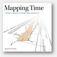
Thinking about time and space

Menno-Jan Kraak has just released a new book on "Mapping Time" which deals with the issue of visualizing time over space.  Currently available as a hard cover (and soon to be in VUW's library!) as well as a soon to be released ebook.


Thursday 12 June 2014

Monday 2 June 2014

Googling in 3D


Looks like Google are producing a tablet that allows you to map your surroundings in 3D.  I'm not sure whether to be creeped out or impressed...